 Finally, the maps are willing to show themselves.
This is a portion of a FAA Sectional map for this region showing the Portland-Vancouver area metroplex and a little south and southwest of Portland. Sectionals show location and length of area airports and landing strips, indicate vital information about radio and navagation frequencies, and scores of other critical and essential safety information. Just inside the larger circle around Portland Airport (PDX) on the right side above the river is a small strip named "Grove". That was our starting point. Over at the lower left of the map and SW of Portland is the city of McMinnville where we were going. That is where the Air Museum is located. You can tell somewhat how complex the sectional is and how important it is for your pilots to be thoroughly familiar with the details it contains.
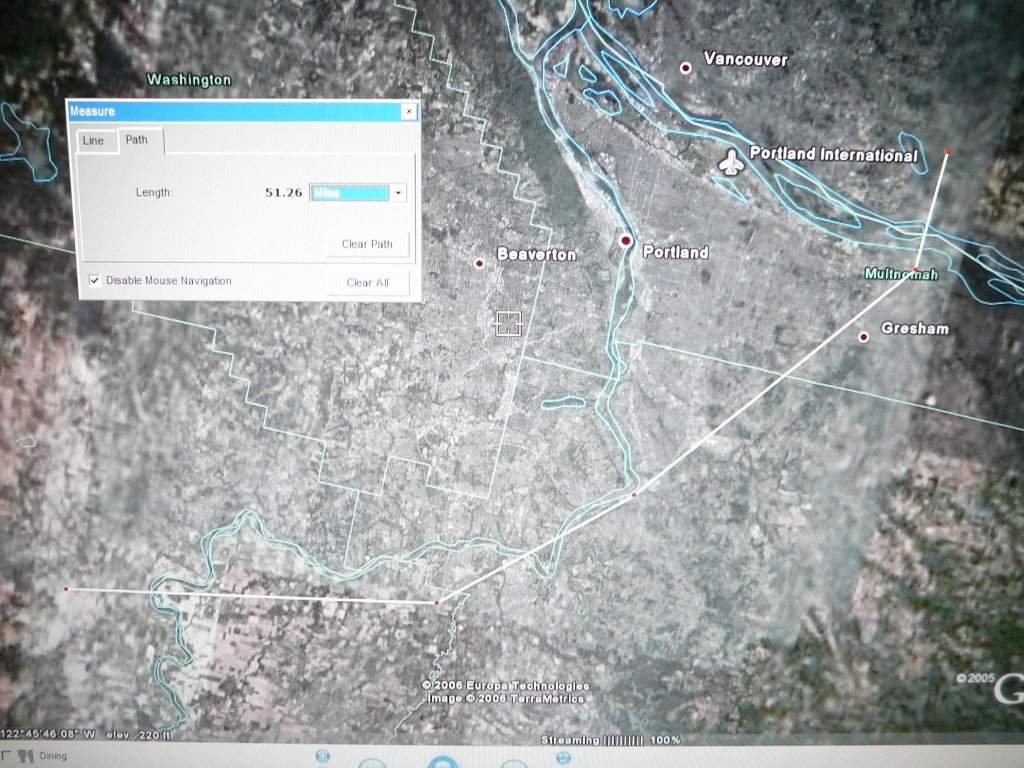
The second map is a modified image from Google Earth which has our route overlaid on just about the same area as the other map represents. The overall length of hte trip shows in statute miles although most pilots do their planning in nautical miles which are a bit longer. We flew the 50 or so miles averaging about 45 minutes each way. At each of the major angles, we overflew another airport since that is often the safest way to avoid other aircraft in their landing and takeoff patterns. Most of our flight was between 1200 and 1500 feet which is a wonderful height from which to view the surface. I like the water features: ponds, lakes, rivers, and such for the colors they display. This trip I was somewhat stunned at the large areas of development scraping away trees and farmland and completely altering the formerly quiet and pastoral countryside. How many subdivisions and strip malls do we need anyway?. One more note: David is a good pilot and I am completely comfortable with him at the controls. What a fine way to spend a day. (TNX, DMW. You are special!)
posted by Papa John @ 4:18 PM
0 comments
![]()

0 Comments:
Post a Comment
<< Home