EXPERIENCING THE ICE AGE FLOODS, PART II
Please understand that the emormity of the Ice Age Floods is difficult to describe as it take a diligent effort even to begin to grasp the sequence and scope and devastation of a series of flash floods which swept some 700(?) miles from Western Montana to the Pacific Ocean in only a few days while severely thrashing the earth's surface where it passed. Walls of water hundreds of feet deep and miles wide traveling at speeds sometimes approaching 100 miles per hour are not easy to imagine, but their existance is clearly and dramatically left upon the surface which remains. These floods were periodic and reoccured each time the glacial lakes reformed and filled until they caused their ice dams to fail, at which moment another giant flood was on its way across the land.
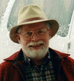
The first photo shows son David, our pilot, and Bruce Bjornstad, our guide and "guest lecturer" whom David invited along to point out the features we would be seeing on a three hour flight to the north of Richland, Washington. The area we were able to cover represents a very small portion of the entire flood plain altogether. I would guess our entire flight path may have been a little over 300 miles, a mere token of the total square mileage the floods affected. Still in this and a couple of more blogs, I will try to share some photographs and descriptions of these stunning geological evidences of watery chaos long ago. One more disclaimer; although being airborn and having an expert detail the features helped us see the evidence, taking candid shots with a small digital "point-and-shoot" through the plastic of an airplane window does not hope to include all that is on display nor does it begin to help pull all the features into a meaningful relationship. To do that, read the recommended books, view the videos sometimes shown on PBS ststions, and either drive or fly the flood regions yourself with your own guides or guidebooks. You can not help but be awed. (This explanation also applies to future blogs on this subject.)
Remember the water basically travelled west out of Montana and across Idaho, southwest across eastern Washington (roughly from Spokane to the Tri-Cities), and after a two or three episodes of ponding into temporary lakes, it finally squeezed into the Columbia River George and headed westward toward Portland and the sea beyond. Unfortunately, the first half of our sightseeing route took us north, quartering across the general flood-flow in an upstream direction. Even on the vast and mostly level-looking landscape, various local features which rose even a few hundred feet above the plain had considerable influence on where the bulk of the flood waters could travel easily. Just north and east of the Hanford Reach portion of the present Columbia River path, the floods encountered a couple of east-to-west highlands; first, Frenchman Hills between Vantage and Moses Lake and secondly, the Saddle Mountains west of Othello. From the air neither seem very dramatic, but they were tall enough to cause the deluge to divide around them speeding the flow at each end and causing remarkable local changes in the surface of the land. The previous photo is of the Drumheller Channels (named by Bretz after the owners of a local ranch) where the waters not only scoured the soils away leaving deep, braided and interlaced ravines but carved out deep, often elongated lakes which persist even today. In the following shot the random channeling can be seen interspaced with occasional taller buttes remaining that were strong enough to withstand the onslaught of the passing flood.
The last picture in this series shows the Frenchman Hills from the east end looking to the west. From our elevation it was hard to see how this little range, only a few hundred feet high, could be tall enough to reroute the flood waters, but it did. Study the slope of the fields to left and right to discern the run of the ridgeline. At both ends of the Hills, remarkable features were formed as the waters piled upon themselves getting around this obstacle. Besides the scarring of the Drumheller Channels on the east, the Frenchman Coulee formed to the west where the water poured at last over the final parapet into the Columbia River valley. I'll show a photograph of that in another blog later.
I'll admit to one problem I had while enjoying this flight. I was often so intrigued by what I was seeing all around us and hearing narrated from Bruce that I just simply forgot to take pictures of some of the features we were flying over. I'm hoping to join David again on future explorations.


0 Comments:
Post a Comment
<< Home